Open Data Love
We love OPEN SOURCE! It is the heart and soul of GOAT since the beginning. For that reason, GOAT’s architecture is completely built with an open source software, anyone can contribute while the operation and functionality of GOAT is completely free. Therefore, GOAT is mainly built with OpenStreetMap (OSM) data. Their geographical data is an indispensable data source for countless projects worldwide, and that is thanks to the thousands of mappers and contributors around the globe. We are keen to not only consume this data but moreover to contribute new data to the whole community. Therefore, we are mapping locally, wherever possible, when setting up GOAT in a particular study area.
OSM Mapping Mode
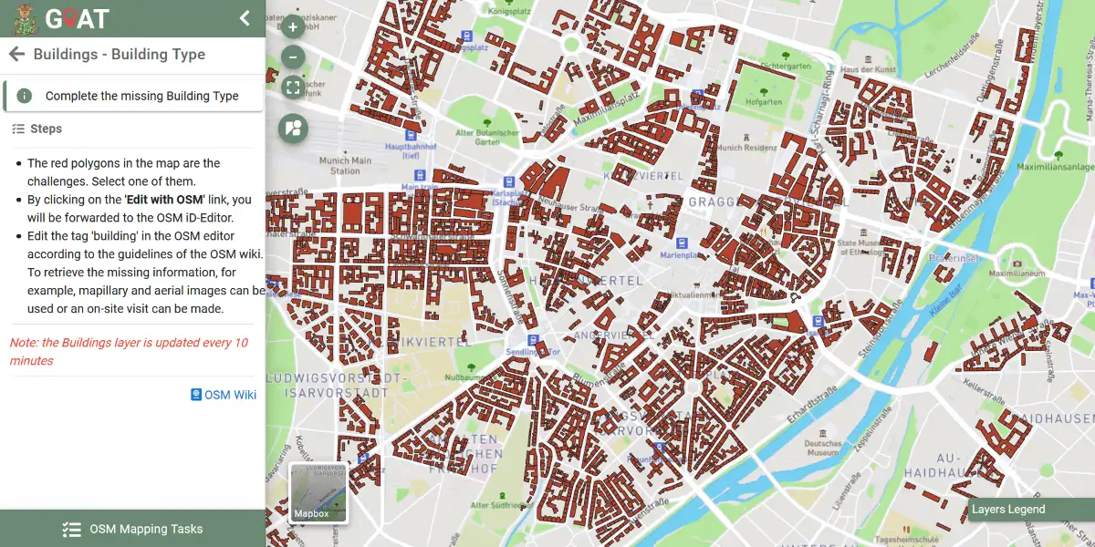
We are very excited to announce a new way to improve the OpenStreetMap data used by GOAT via its user interface. This feature is called OSM Mapping Mode.

With this new feature, we are introducing a new way to edit OSM-data without leaving the GOAT-tool. Moreover, we are looking to focus on and make it easier to improve the data required by the features of GOAT. How does it work? The topics and data that needs to be completed are organized as tasks. Right now, there are tasks available for completing the information about building types, the maximum speed and the quality of the surface of the streets, as well as the opening hours of points of interest. But the type and number of challenges will be updated in the future. In the images below you can see how the mapping challenges look like in GOAT. To know more about how you can contribute to the operation of GOAT through this tool please watch this tutorial.

You are very welcome to test the OSM Mapping Mode in the GOAT versions of Munich, Fürstenfeldbruck and Freising and help the community closing data gaps.
MapRoulette
In Fürstenfeldbruck and Freising, we created additional mapping challenges in a tool called MapRoulette. The system works very similar by setting tasks related to the information that we want to improve. So far, we have set three tasks in MapRoulette, two for Freising and one for Fürstenfeldbruck. All three tasks are related to the update of opening hours of POIs (see image below).

We thank you for your interest in improving the OSM-data. OSM is the best source for geographical information thanks to thousands of people who work on data collection and keep the data up to date. Improving the information available to everybody is part of our DNA. We are committed to improve the information available in our local context by developing the OSM Mapping Mode and using MapRoulette. The collected data will update directly the OSM database and will be frequently used to update the database of GOAT. With a better quality of the available data, we can enhance the operation and results of our tool.