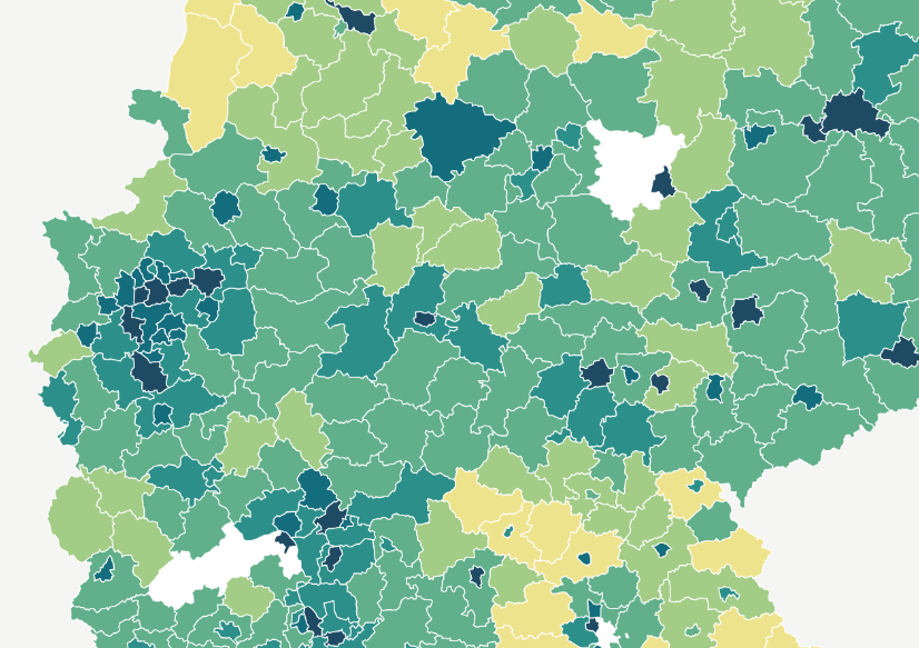
Overview
For the city of Amberg with its historic city centre, two reports have so far been produced using GOAT. The first report analysed how accessible the various destinations in Amberg's city centre are from the parking facilities. In the second report, different variants of a new cycle path connection were analysed and compared.
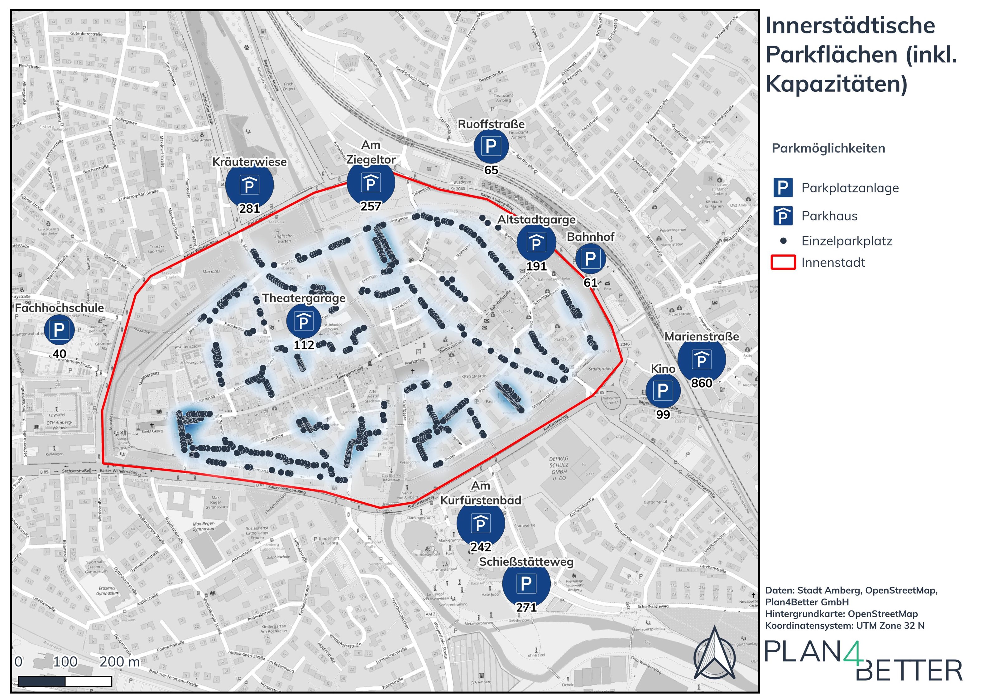
Inner city car parks
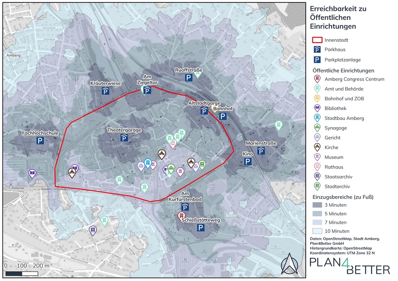
Walking accessibility to public facilities
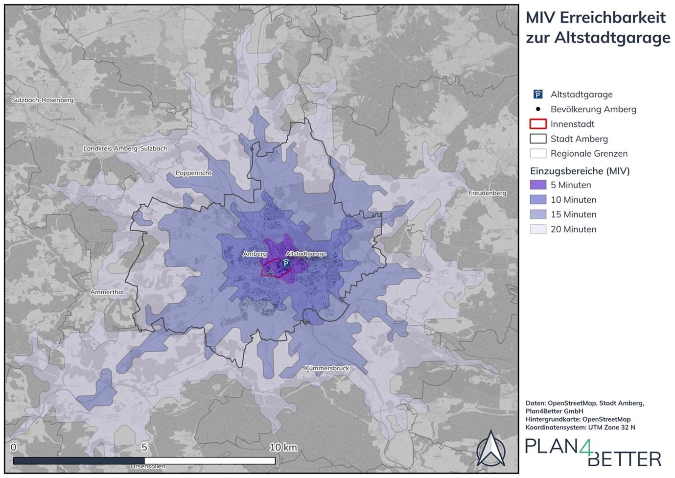
Car accessibility of car park „Altstadtgarage”
Accessibility analysis of parking facilities in Amberg city centre
In a report, the current parking situation in Amberg city centre was examined using the planning tool GOAT and various accessibility analysis. The focus was on the accessibility of various points of interest (POIs) both by active modes and by motorised private transport. Specifically, the following four questions were answered and visualised using appealing maps:
- How good is the accessibility to public parking garages and on-street parking by private motorised transport?
- How good is the accessibility to Amberg Markplatz by bicycle?
- How good is the accessibility of various important POIs from the public parking garages and on-street parking on foot?
- Where are there gaps in the parking offer?
Accessibility analyses for the planned cycle path project “Höchste Eisenbahn” in Amberg
In a report, the planned cycle path in Amberg was modelled using the GOAT planning tool and examined on the basis of various accessibility analyses. The aim of the report was to determine the effects of the planned cycle path on the accessibility of the population and important points of interest (POI). Specifically, the following question was answered and visualised using appealing maps:
What accessibility gain does the new cycle path bring compared to the current situation…
- … without underpass (variant 1)
- … with underpass (variant 2)