Overview
In the context of the GOAT 1.0 development project, the GOAT planning software was developed from a prototype to a mature version 1.0. Both the user interface and a large number of functionalities were refined in the process. The development took place in a co-creative process, in close cooperation with the municipalities of Fürstenfeldbruck, Freising and Munich. During the project, GOAT was used by local planners to evaluate the effects of new path connections and to check the distribution of amenities of daily need.
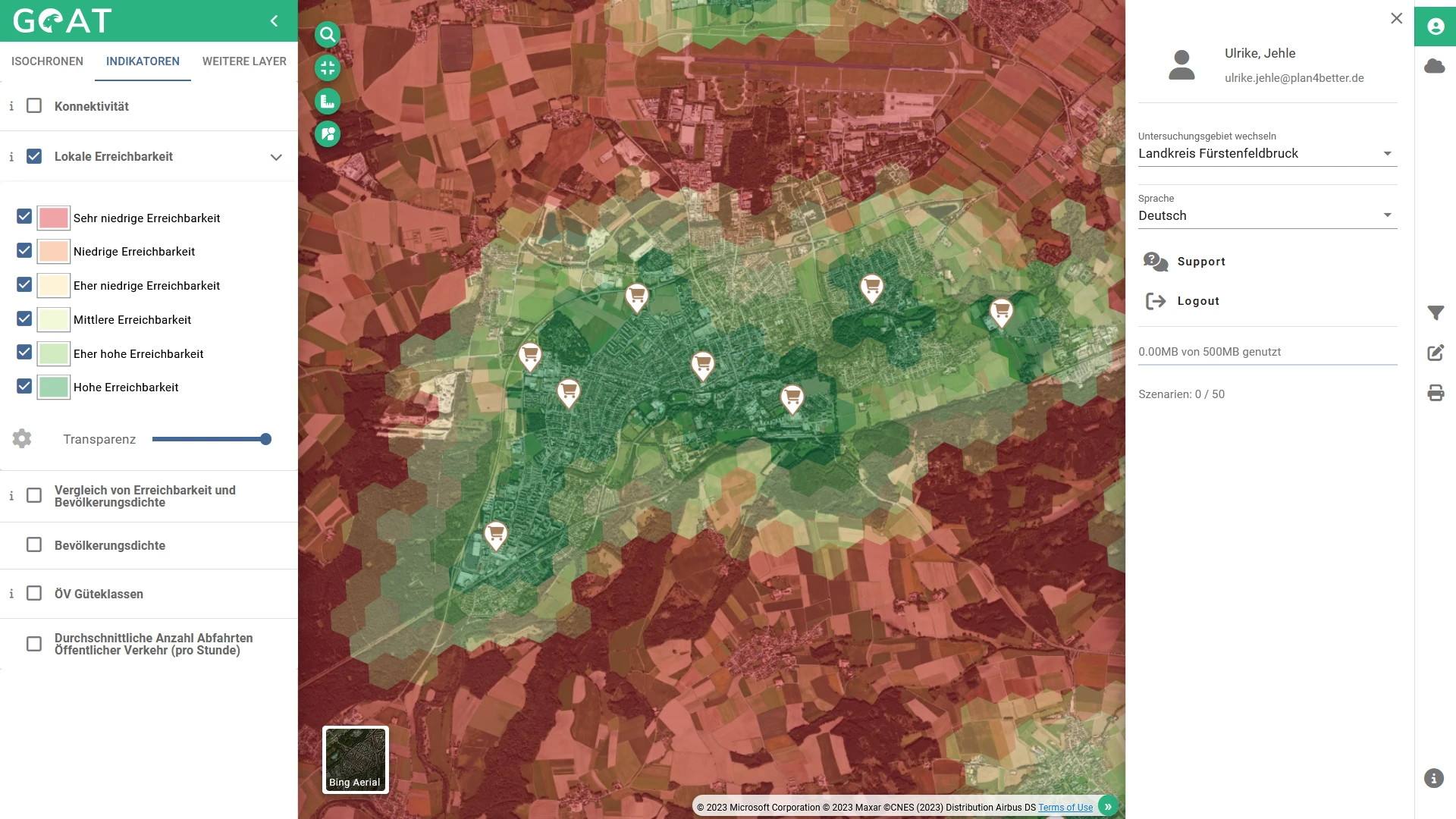
Accessibility to supermarkets in Fürstenfeldbruck
×
![]()
Accessibility to supermarkets in Fürstenfeldbruck
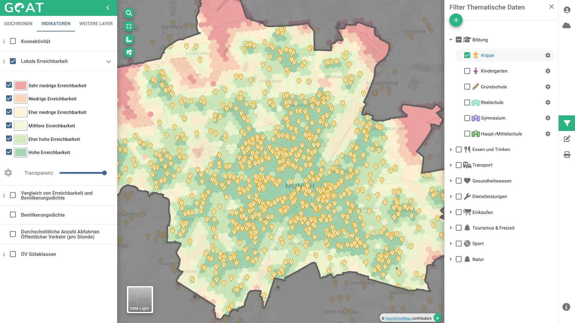
Accessibility to childcare facilities in Munich
×
![]()
Accessibility to childcare facilities in Munich
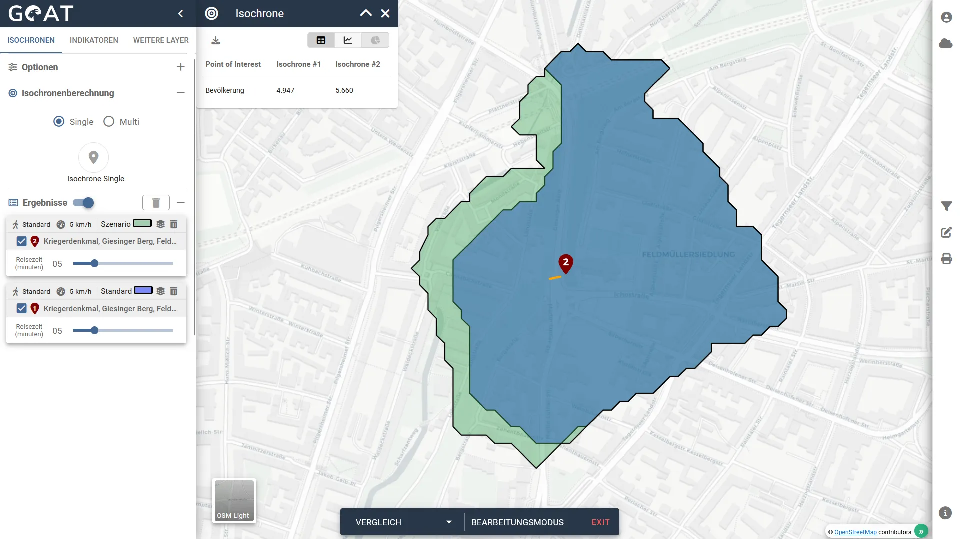
Planning of new cycle path connection at Giesinger Berg
×
![]()
Planning of new cycle path connection at Giesinger Berg
Blogposts about this project:
Scientific publications:
- Accessibility by proximity: Addressing the lack of interactive accessibility instruments for active mobility
- Assessment of the usefulness of the accessibility instrument GOAT for the planning practice
Further information: