Overview
As a basis for planning the redesign of six neighbourhoods in the metropolis of Istanbul, GIS-based accessibility and walkability analyses were carried out (including accessibility of destinations for daily needs, illustration of path qualities). The aim was to identify weak points and develop possible measures. For this purpose, various spatial data were merged and analysed using different GIS-based methods and algorithms. In addition, building-specific structural data such as the distribution of population and activities was used to calculate pedestrian flows, which served as the basis for further prioritisation of measures.
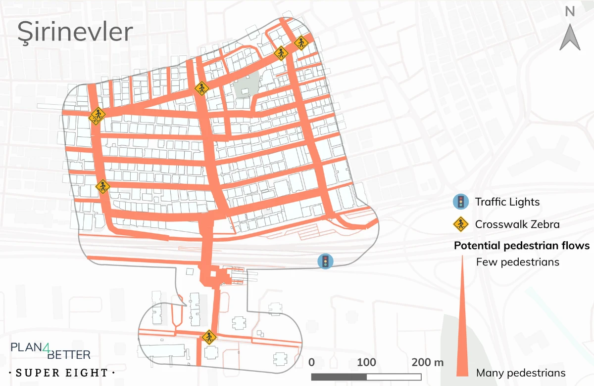
Potential pedestrian flows
×
![]()
Potential pedestrian flows
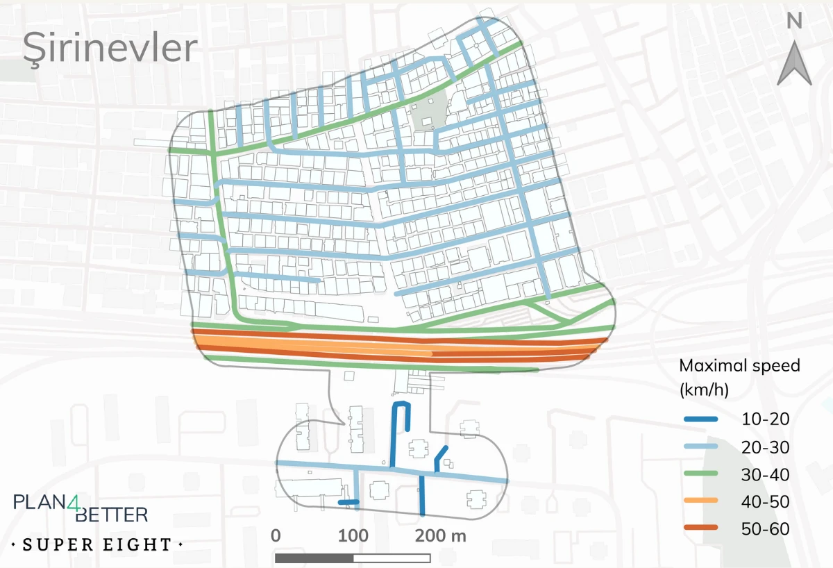
Car speed
×
![]()
Car speed
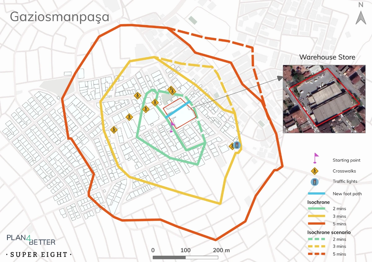
Analysis of the effects of a new footpath connection
×
![]()
Analysis of the effects of a new footpath connection