Overview
The developed web application is responsive and uses open source software as well as open data. It is made possible by the integration of various geodata, mobility data, routing algorithms and WebGIS technologies. The main goal is to provide tailor-made routing solutions that meet the specific needs of users. In particular, people with mobility limitations should benefit from alternative route options that are specifically tailored to their needs. For example, physically impaired people or people with strollers may specify that they prefer slightly longer walkways over stairs. Another focus of the application is the visualization of a large number of mobility offers (e.g. public transport stops, bike sharing), which are included in the route calculation. This results in a high degree of personalisation and accuracy of route planning.
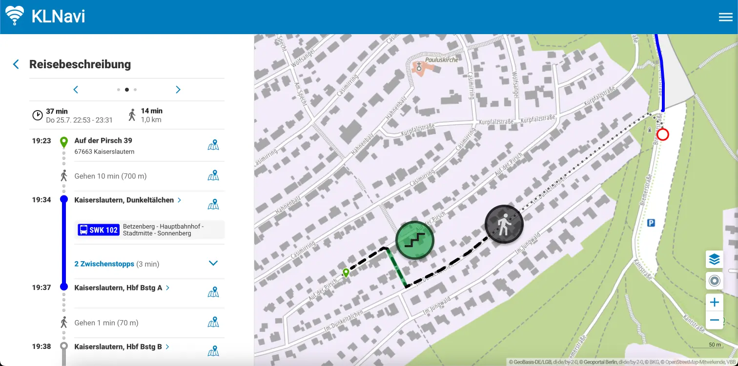
Walking routing
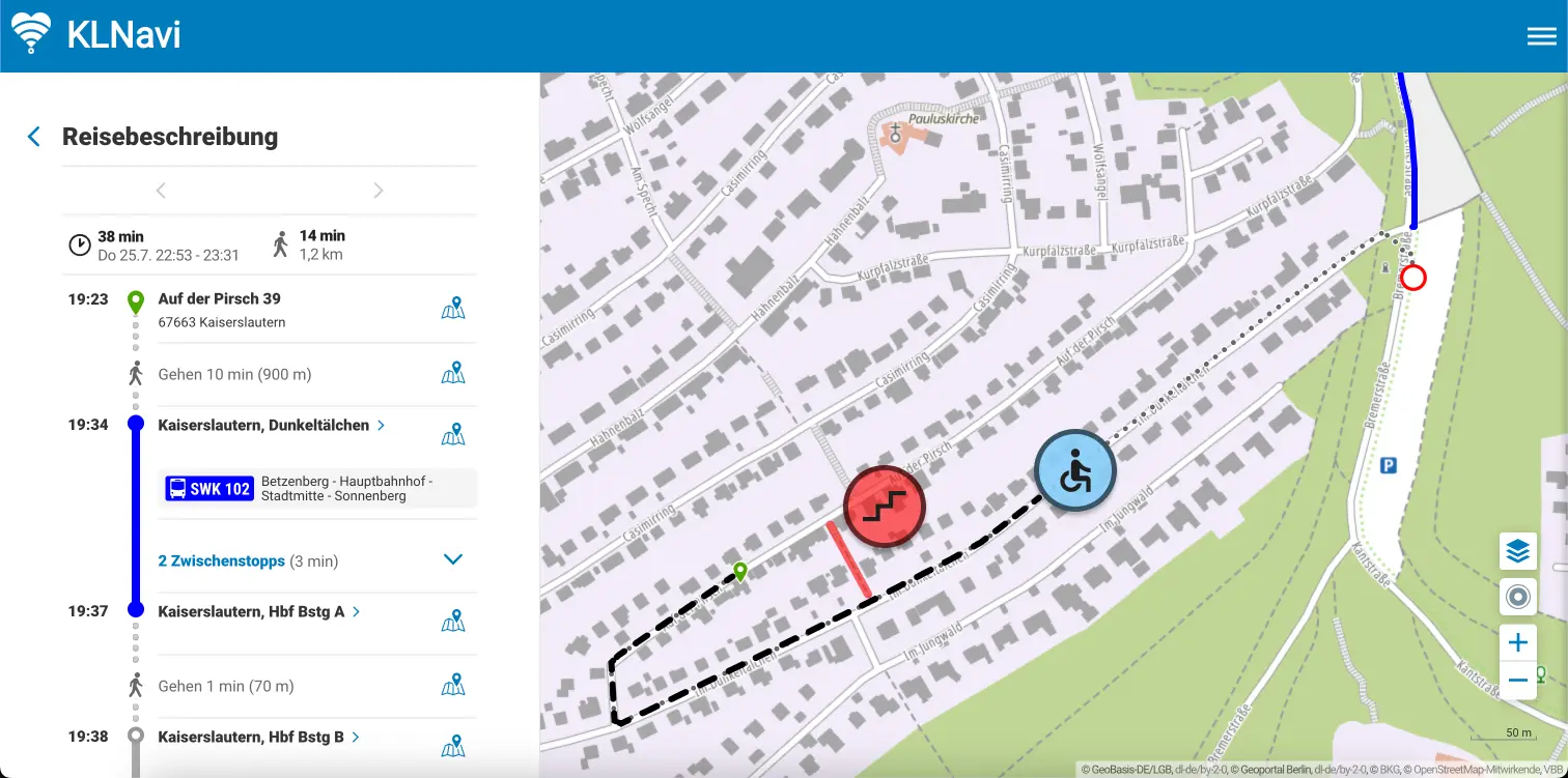
Wheelchair routing
Methodology and implementation
As in many of our other projects, based on data pipelines from GOAT, a lot of data was refined and used for route calculation. Our approach is characterized by high flexibility. It is aimed at long-term maintenance and can easily be transferred to other cities.