Overview
In cooperation with the TUM Chair of Urban Structure and Transport Planning and Humankind, we developed the citizen GIS "Map4Citizens". The aim of the three-month project was to close the information gap between citizens and planners by opening up data and providing reliable and easy-to-understand mobility analyses for everyone. As part of our project, we developed a mobile-enabled, web-based application that allows users to quickly get an overview of important mobility-related parameters in their city and neighbourhood.
Map4Citizens
×
![]()
Map4Citizens
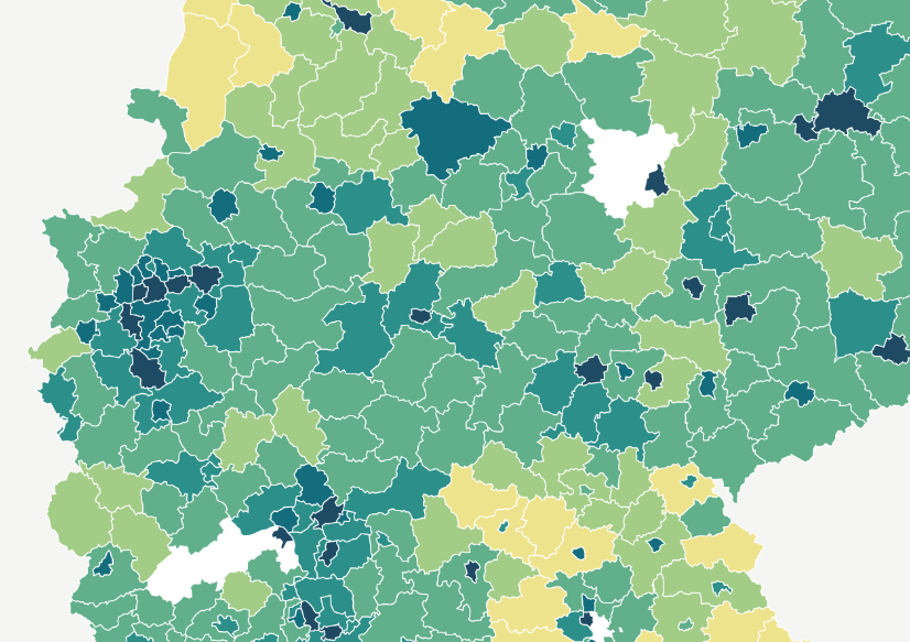
15-Min-City Score
×
![]()
15-Min-City Score
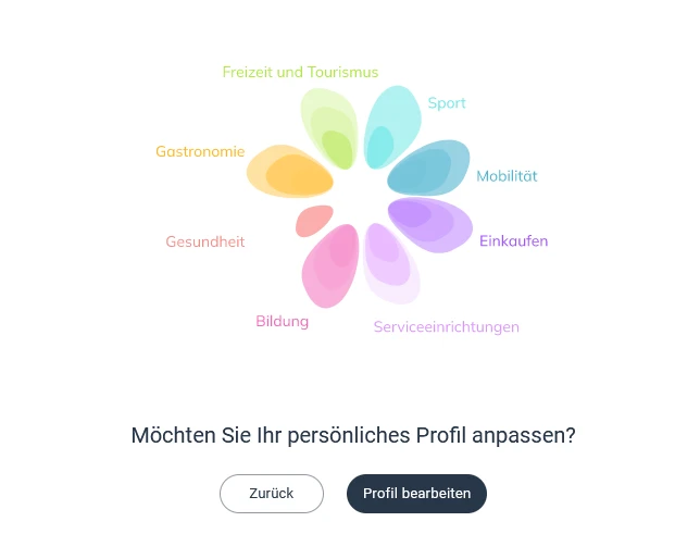
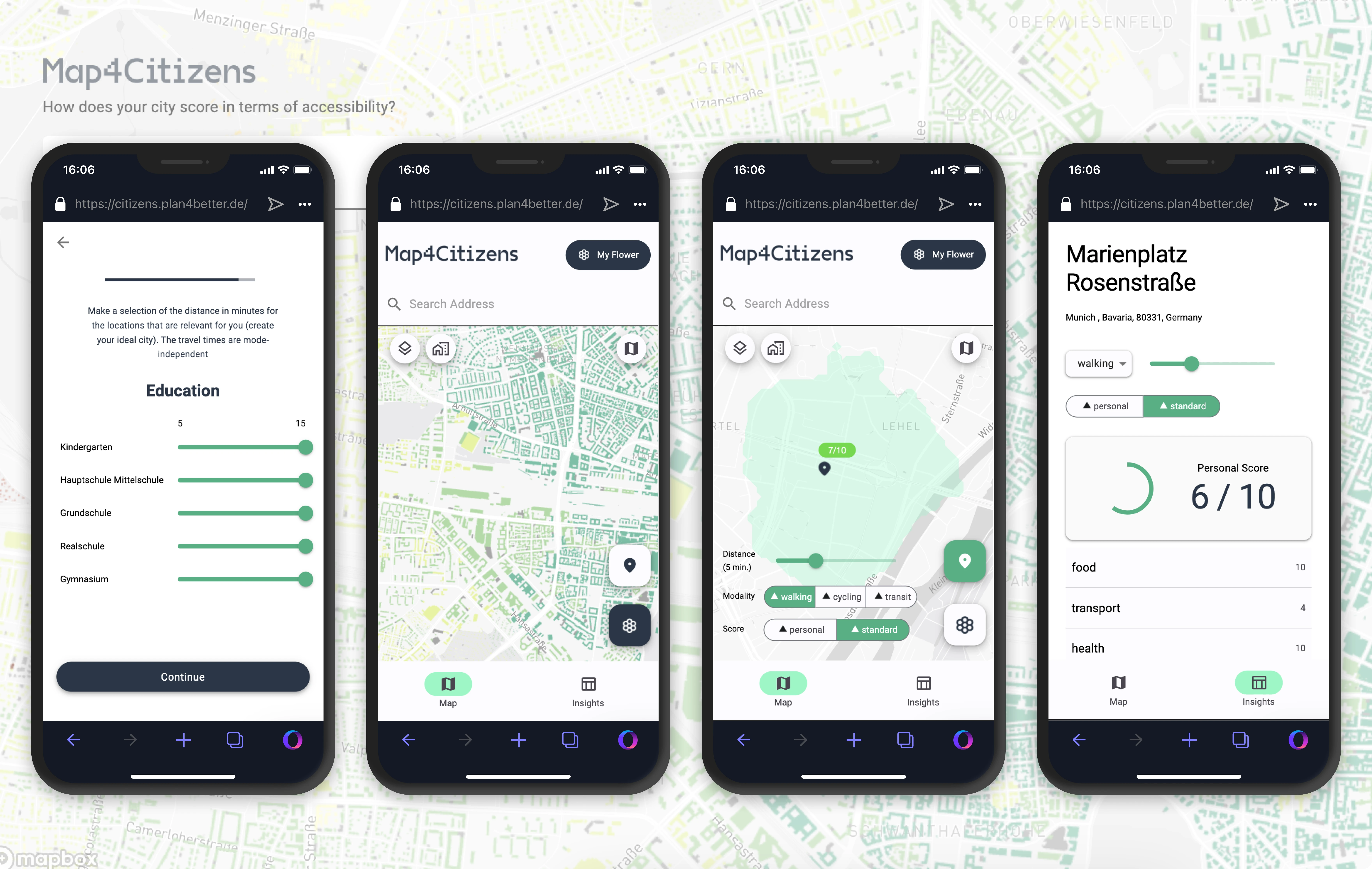
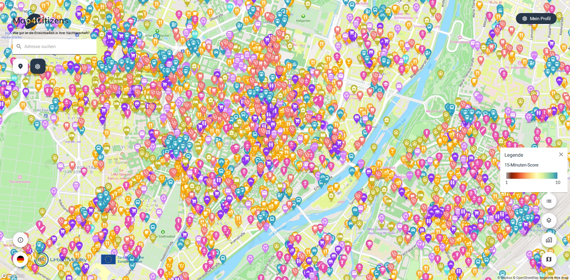
Individual analyses for the 15-minute-city
×
![]()
Individual analyses for the 15-minute-city
Link to the application:
Blogpost about this project: