Description of the feature
GOAT allows you to integrate your own external layers. With a huge selection of geographic maps, you can customize your analysis. You can either choose from the preset layers or add your own by using “source url”.
Possible use cases
- Adding layers with additional information, such as the broadband mobile communities 5G, from Geoportal as external layer.
- Adding individual basemaps for your analyses.
Video Tutorial
Step-by-step tutorials to work with external layers
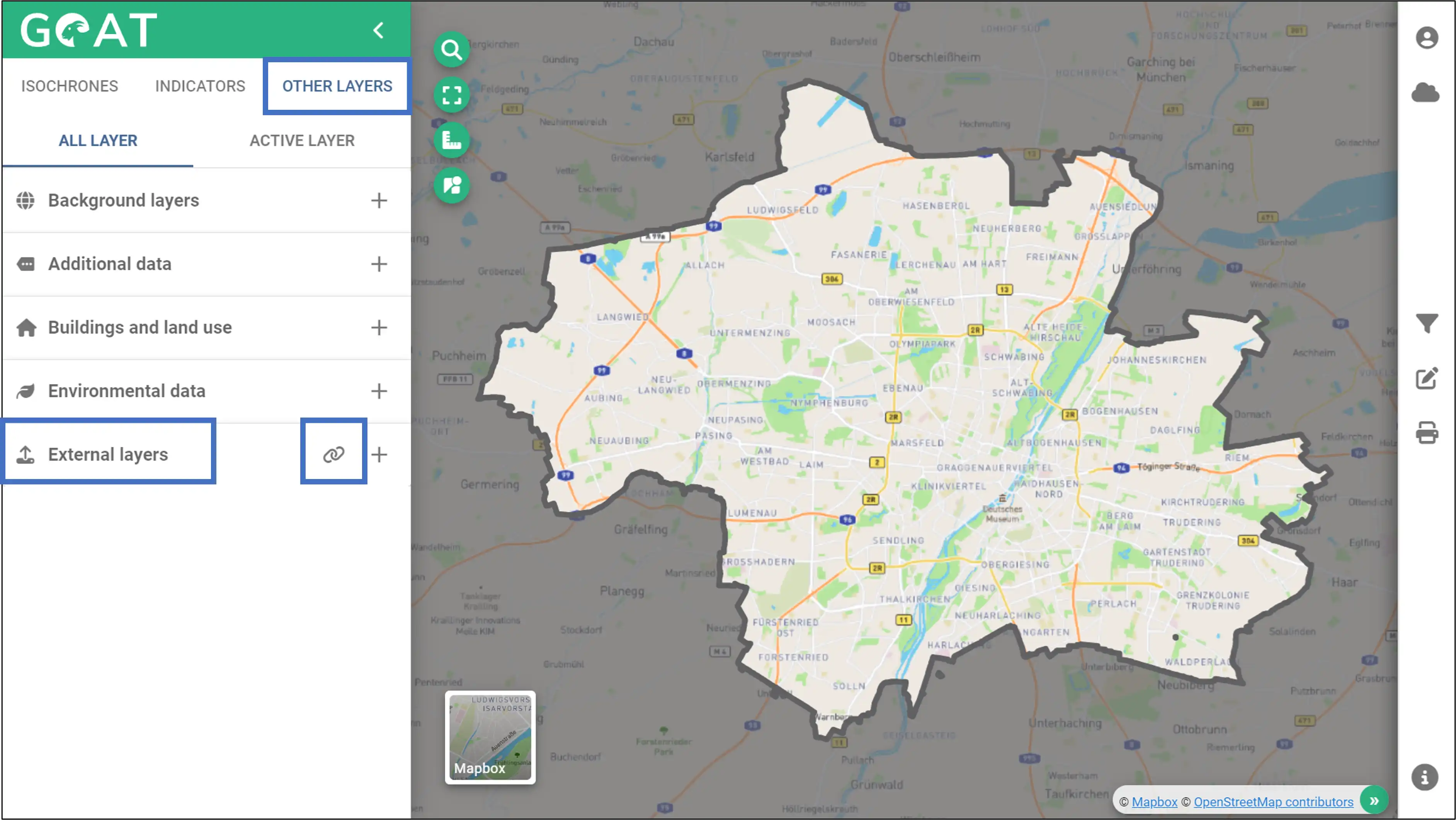
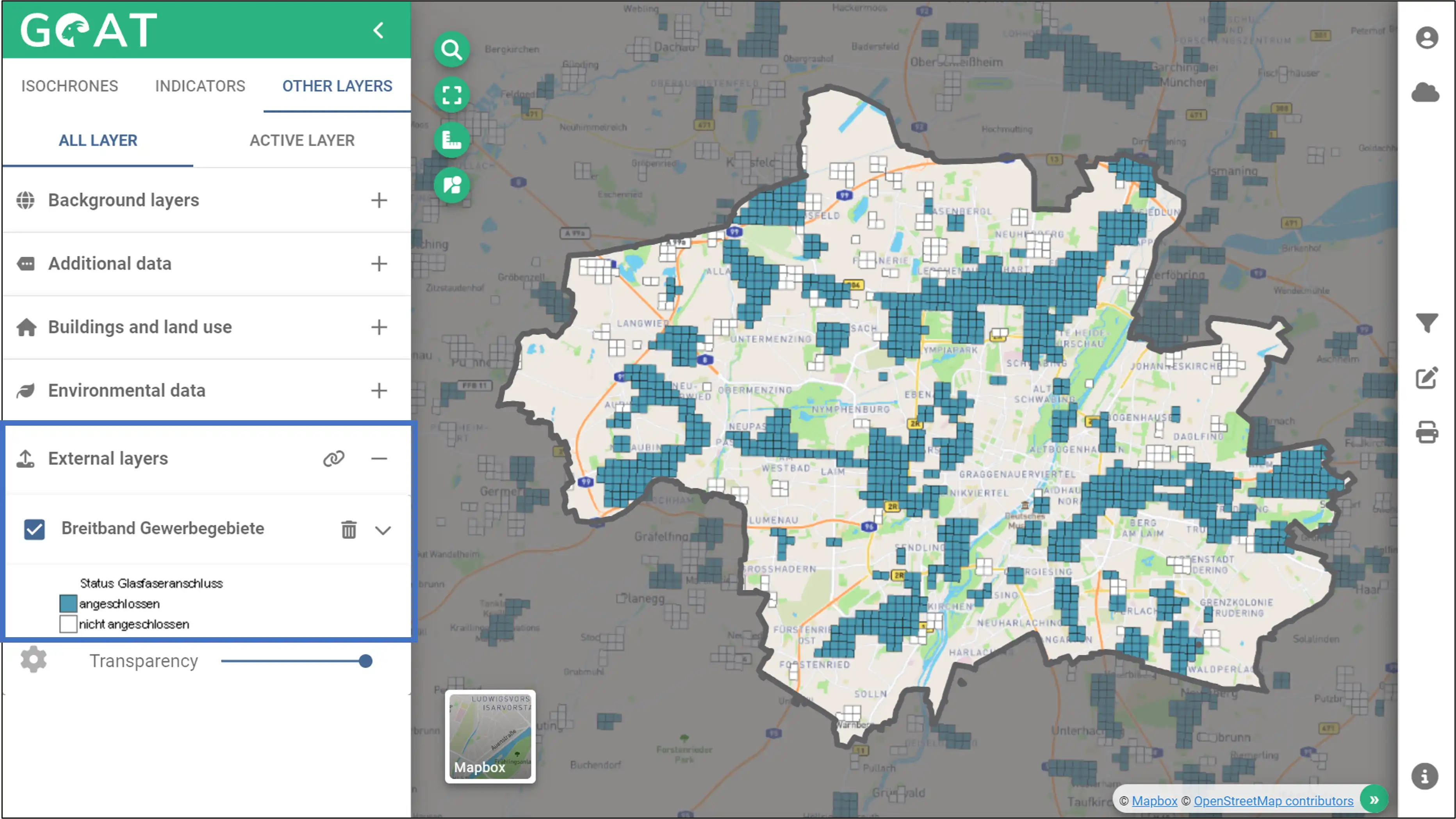
1 Select a predefined layer from the geoportal
- Click on “Other Layers” and click on the link icon next to the external layers.
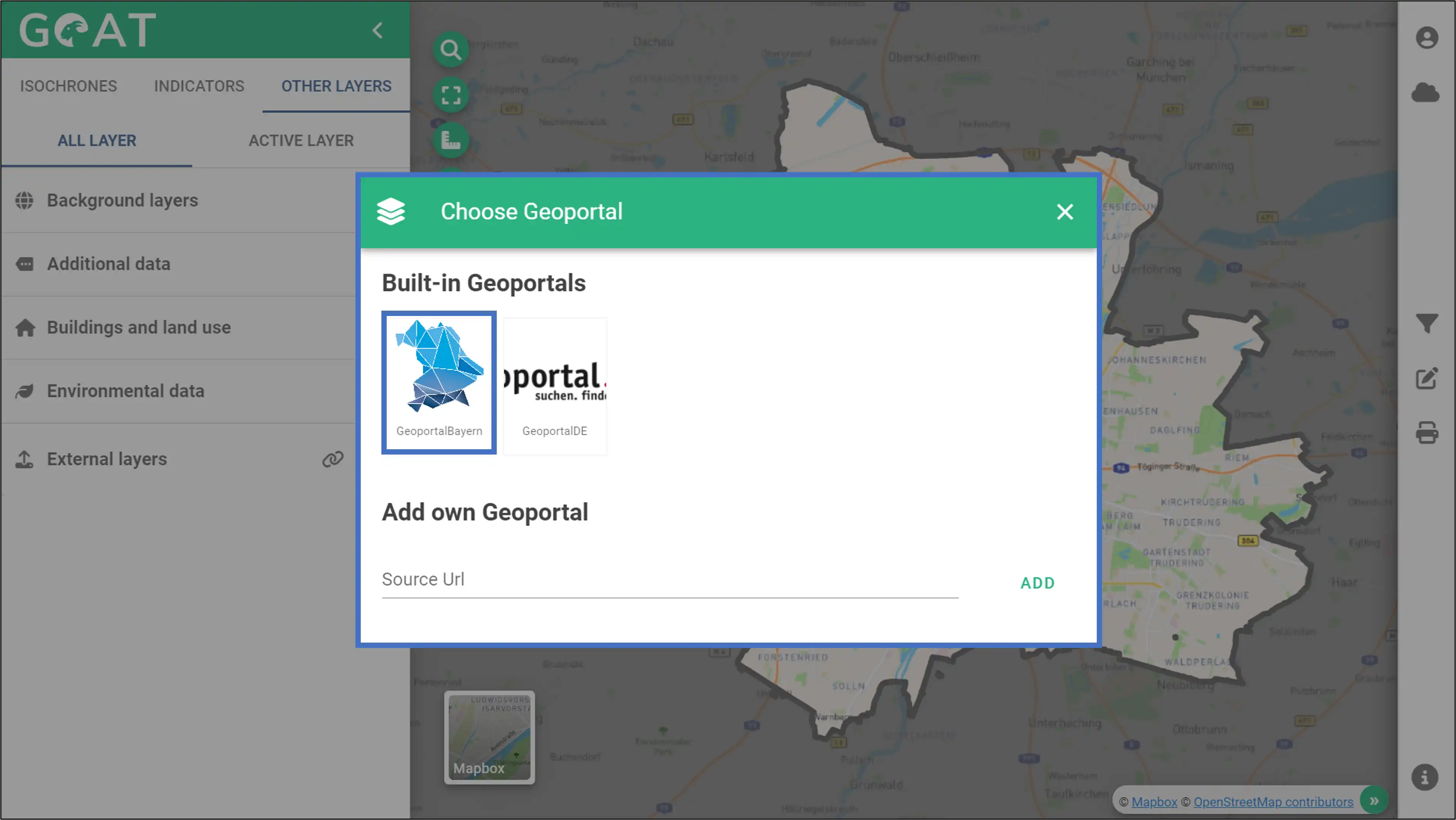
- In this window you can select a default geoportal or add a layer by entering your own url. In this example, we are selecting the GeoportalBayern for Munich.
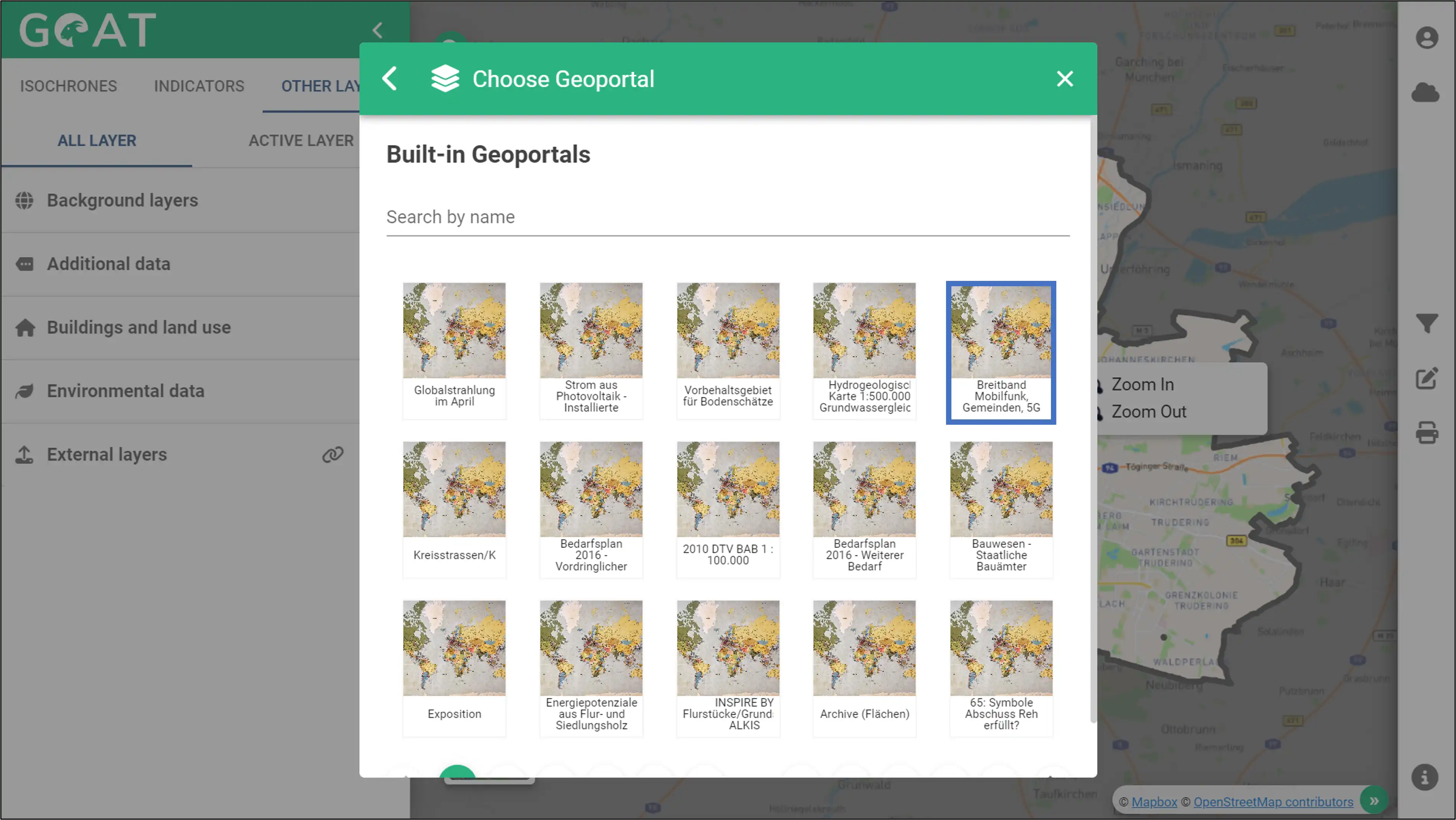
- There are many layers in this geoportal. In this example, click the layer indicated in the blue box and continue. Note that depending on the current state of the provider, some layers may not be working.
- You can see the basemap changes on the map as you move your mouse over the layers. Select the first one and to add the layer click the “plus” icon.

- You can access the layer, view its symbology and legend information, or remove it.
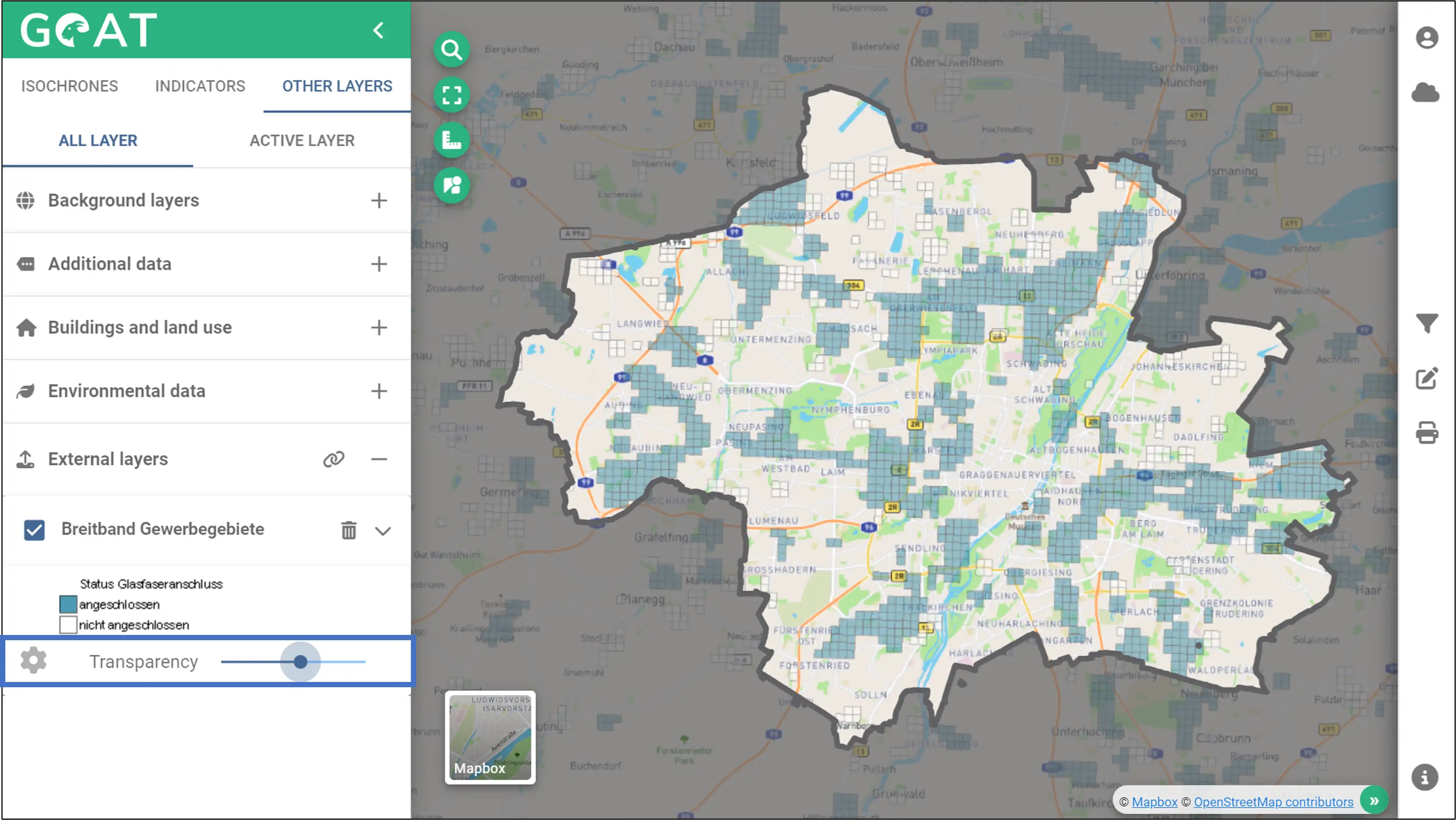
- The Transparency can be changed using slider.
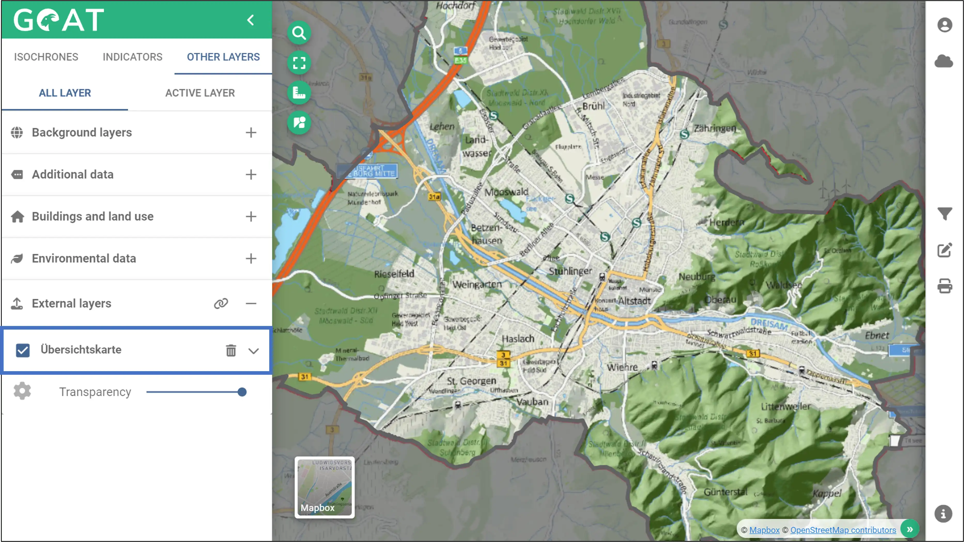
2 Import a layer via URL
- You can add a WMS layer by using your own url. Paste the GetCapabilitiesURL for your layer in the field “source url” and click “add”. A source URL for Freiburg is utilized in this illustration.
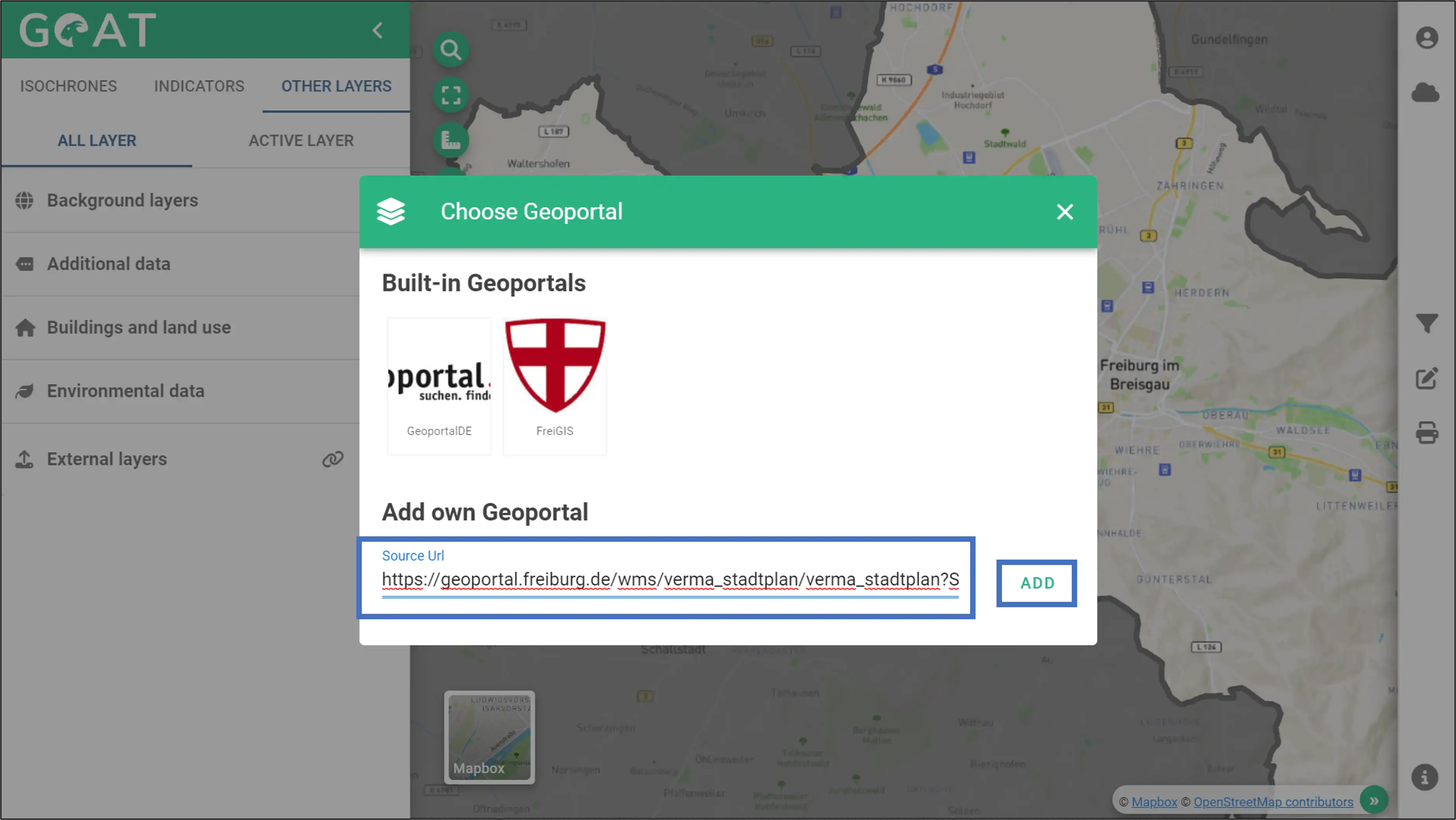
- Click the “plus” icon to add the layer to the map.

- You can access the layer, view its symbology and legend information, or delete it via the menu on the left.